

































































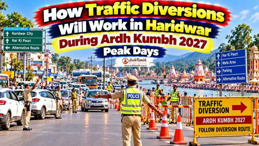
How Traffic Diversions Will Work in Haridwar During Ardh Kumbh 2027 Peak Days
Complete guide to traffic diversions in Haridwar during Ardh Kumbh 2027 peak days. Learn NHAI bypass routes, parking zones, shuttle services and emergency corridors.
How Traffic Diversions Will Work in Haridwar During Ardh Kumbh 2027 Peak Days
Quick Answer ⚡: During Ardh Kumbh 2027 peak days in Haridwar, traffic diversions will operate on a multi-layered system. Interstate vehicles from Delhi, Meerut, and Saharanpur will be diverted via the 51-km six-lane Spur to Haridwar project, bypassing the city core entirely. The 15-km Haridwar Bypass from Bahadrabad to Chandi Devi Temple will divert traffic away from congested zones including Har Ki Pauri, Chandi Chowk, and Shankaracharya Chowk. Private vehicles will be stopped at outer parking zones, with shuttle services transporting pilgrims to the ghats. A dedicated emergency evacuation corridor from Laltaro to Chandighat will provide rapid exit during peak bathing festivals. An Advanced Traffic Management System (ATMS) will enable real-time monitoring and route adjustments based on crowd density.
At a Glance 🔎
| Key Detail | Information |
|---|---|
| Event Duration | 14 January to 20 April 2027 |
| Amrit Snan Dates | 6 March, 8 March, 14 April, 20 April 2027 |
| Spur to Haridwar Project | 51 km, 92% complete |
| Haridwar Bypass (Package-1) | 15 km, 77% complete |
| Bypass Route | Bahadrabad to Chandi Devi Temple |
| Emergency Evacuation Corridor | Approximately 3.5 km (Laltaro to Chandighat) |
| Parking Strategy | Outer parking zones with shuttle services |
| Traffic Monitoring | Advanced Traffic Management System (ATMS) |
| AI Crowd Monitoring | Yes, at Command and Control Centre |
| Control Room | Integrated Command and Control Centre (CCR) |
Understanding the Traffic Challenge During Ardh Kumbh 2027 🚦
The Haridwar Ardh Kumbh 2027 will draw an estimated 17–20 crore devotees over 90–100 days between January and April 2027. Managing the movement of such a massive population through a city with limited road infrastructure is one of the most complex logistical challenges the Uttarakhand government has ever undertaken.
Why Traffic Diversions Are Critical
-
City road capacity — Haridwar's existing road network was not designed for crores of pilgrims
-
Ghat saturation — Har Ki Pauri and surrounding ghats have limited capacity; vehicle access must be restricted
Trending Guides Now
Ardh Kumbh Crowd Management & Facilities Guide
Read Guide →
How Crowd Discipline Is Planned for Ardh Kumbh 2027
Read Guide →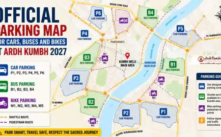
Official Parking Map for Cars, Buses and Bikes at Ardh Kumbh 2027
Read Guide →
How Crowd Diversion Routes Work During Peak Ardh Kumbh 2027 Days
Read Guide →
Ardh Kumbh 2027 Dates (Official) - Haridwar Snan Schedule
Read Guide →
Dharamshala Stay During Ardh Kumbh: Free & Budget Guide
Read Guide →
Official Progress Report of Haridwar Ardh Kumbh 2027 Infrastructure Projects
Read Guide →
Where to Find 24-Hour Pharmacies in Haridwar During Ardh Kumbh 2027 Emergencies
Read Guide → -
Emergency response — Ambulances and emergency vehicles must have clear routes
-
Pedestrian safety — The Kumbh area is being developed as a pedestrian-friendly zone with vehicle-free sectors
-
Transit hub management — Haridwar Railway Station and Bus Stand handle lakhs of arrivals daily
Expert Tip 💡: The Mela Officer Sonika has stated that the traffic plan is being developed by assessing the impact of crowds from different locations on each area. Routes and diversion arrangements will be dynamic — adjusted based on real-time crowd density and AI-based monitoring data.
The Foundation: NHAI Road Projects Reducing City Congestion 🛣️
Before understanding traffic diversions within Haridwar, it is essential to understand the major highway projects that will divert traffic away from the city core entirely.
Spur to Haridwar Project
The 51-km six-lane access-controlled Spur to Haridwar is the single most important infrastructure project for Kumbh 2027 traffic management.
| Feature | Details |
|---|---|
| Length | 51 km |
| Completion Status | Approximately 92% complete |
| Route | Halgoya Mustkam to NH-58 near Bhaderi Rajputana |
| Purpose | Connects Delhi-Dehradun Economic Corridor to Haridwar |
| Key Benefit | Allows vehicles from Delhi, Meerut, and Saharanpur to bypass inner-city roads |
Once operational, the Spur to Haridwar will divert interstate traffic before it enters the city, significantly reducing pressure on Haridwar's urban roads. Vehicles coming from Delhi, Meerut, Saharanpur, and western Uttar Pradesh will have an alternative high-speed route that avoids the congested city core entirely.
Haridwar Bypass (Package-1)
The 15-km Haridwar Bypass will divert traffic away from congested urban zones including Har Ki Pauri, Chandi Chowk, and Shankaracharya Chowk.
| Feature | Details |
|---|---|
| Length | 15 km |
| Completion Status | 77% complete |
| Route | Bahadrabad to Chandi Devi Temple on NH-34 |
| Key Benefit | Diverts traffic away from Har Ki Pauri and Chandi Chowk |
The bypass is specifically designed to reduce traffic pressure in key parts of the city during festivals and religious events.
Advanced Traffic Management System (ATMS)
NHAI is implementing an Advanced Traffic Management System on the Spur to Haridwar, Haridwar Bypass, and Haridwar-Muzaffarnagar routes.
-
Real-time traffic monitoring — Live data on vehicle movement
-
Dissemination of information — Alerts to commuters about congestion
-
Enforcement support — Automated violation detection
-
Quicker emergency response — Faster dispatch of ambulances and police
Pro Tip 🧭: The ATMS will allow traffic authorities to adjust diversion routes in real-time based on congestion patterns. Pilgrims should follow dynamic signage and app-based alerts rather than relying on pre-planned routes alone.
Traffic Diversion Zones: How the City Will Be Segmented 🗺️
The Haridwar Mela administration is dividing the Kumbh area into 32 sectors for crowd control, traffic management, and emergency response. Traffic diversions will operate on a zone-wise basis, with different rules for different areas.
Zone-Wise Traffic Management
| Zone | Area | Traffic Rule |
|---|---|---|
| Zero Zone | Har Ki Pauri core area | Complete vehicle-free; pedestrian-only |
| Zone 1 | Brahmakund and surrounding ghats | Restricted access; emergency vehicles only |
| Zone 2 | Mela area sectors | Shuttle services only; no private vehicles |
| Zone 3 | Outer Mela periphery | Limited vehicle access; parking at designated zones |
| Zone 4 | City entry points | Traffic diversion to outer parking zones |
| Zone 5 | Highway approach roads | Interstate traffic diverted via Spur and Bypass |
The Zero Zone: Vehicle-Free Har Ki Pauri
The Har Ki Pauri area will operate as a zero zone with complete vehicle restrictions during peak days. This means:
-
No private vehicles allowed near Har Ki Pauri
-
No auto-rickshaws or e-rickshaws in the immediate ghat area
-
Only emergency vehicles permitted with special authorization
-
Pilgrims must walk the final stretch to the ghats
Local Insight 📍: The Zero Zone concept is being extended to the narrow lanes of Haridwar's old city. These lanes are being made clean, attractive, and traffic-friendly to ensure smooth pedestrian movement.
Parking Strategy: Outer Zones and Shuttle Services 🅿️
Private vehicles will not be allowed to enter the core Mela area during peak days. Instead, a park-and-ride system will operate from outer parking zones.
Parking Zone Locations
| Parking Zone | Location | Best For |
|---|---|---|
| Rodi Belwala | Outer Haridwar | Pilgrims from Delhi, western UP |
| Khadda | Outer Haridwar | Pilgrims from Dehradun, Rishikesh |
| Bahadrabad | Near Haridwar Bypass | Pilgrims from Muzaffarnagar, Roorkee |
| Maya Pur | Near Har Ki Pauri approach | Local pilgrims |
| Upper Road | Near Post Office | Two-wheeler parking |
Multi-Level Parking for Two-Wheelers
The Mela administration has directed the development of multi-level parking for two-wheelers near the Post Office on Upper Road. This will help reduce traffic pressure on the main city routes.
Shuttle Services
Shuttle services will operate from outer parking zones to designated drop-off points near the Mela area.
-
Dedicated lanes for shuttle buses to avoid traffic congestion
-
Regular frequency during peak hours
-
Additional services on Amrit Snan days
-
Route signs in multiple languages for pilgrim guidance
Expert Tip 💡: The CM Pushkar Singh Dhami has directed that if parking sites are far away, shuttle services should be ensured to bring pilgrims to the Mela area. All basic facilities — drinking water, toilets, lighting — should be provided at the parking sites themselves.
Emergency Evacuation Corridor: A Life-Saving Route 🚨
A dedicated emergency evacuation corridor is being constructed from Laltaro to Chandighat, approximately 3.5 km long.
Purpose of the Evacuation Corridor
-
Emergency exit during Kumbh and main bathing festivals
-
Kanwar Mela evacuation route
-
Rapid deployment of emergency vehicles
-
Crowd dispersal during stampede-like situations
-
Hospital access for ambulances
The corridor is designed to serve as an emergency exit during peak bathing festivals. During the Kanwar Mela, when Haridwar is divided into eastern and western sections, this corridor will be critical for managing pilgrim movement.
Road Improvement: Laltaro to Chandighat
The Laltaro to Chandighat route is being rehabilitated and improved as part of Kumbh 2027 preparations. This route will serve as an alternative corridor to reduce congestion on main roads.
Expert Advice ✨: Pilgrims should note the location of emergency evacuation routes upon arrival. In case of a crowd emergency, follow instructions from police and volunteers to move toward these designated corridors.
AI and Technology: Real-Time Traffic Management 🤖
The Uttarakhand government is deploying advanced technology for traffic management during Ardh Kumbh 2027.
AI-Based Crowd and Traffic Monitoring
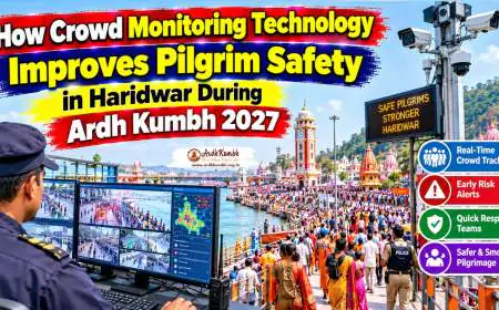
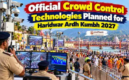
An Integrated Control and Command Centre is being set up for digital management of the Kumbh.
-
AI-based crowd monitoring — Detects crowd density in real-time
-
Traffic pressure alerts — Automatic alerts when routes are congested
-
CCTV surveillance — Real-time monitoring at all key locations
-
Drone surveillance — Aerial views of crowd movement
-
Geospatial mapping — Route planning and diversion management
-
E-passes — Digital permits for authorized vehicles
How the System Works
-
Sensors and cameras collect real-time data on crowd and traffic density
-
AI algorithms analyze the data and predict potential congestion
-
Alerts are sent to the Integrated Command and Control Centre
-
Authorities make decisions on route diversions and shuttle deployment
-
Dynamic signage and app notifications inform pilgrims of route changes
The Mela Officer Sonika has stated that a system is being developed to receive alerts through the technical system if a large crowd suddenly gathers in any area or if traffic pressure increases on any route. Based on these alerts, the administration can take immediate action.
Pro Tip 🧭: Download the official Kumbh Mela app for real-time traffic updates and route information. The app will provide dynamic routing suggestions based on current congestion levels.
Public Transport: Buses, Trains, and Shuttles 🚌
Public transport will be the primary mode of movement for pilgrims during peak days.
Railway Arrangements
-
15 additional trains on major bathing days
-
Five holding areas at Haridwar Railway Station with combined capacity of over 19,000
-
11 stations brought under the Kumbh Mela action plan
-
Special assistance counters for persons with disabilities, senior citizens, and women
Bus Services
-
Shuttle buses from outer parking zones to Mela area
-
Dedicated lanes for shuttle services
-
Additional buses on Amrit Snan days
-
Real-time bus tracking via ATMS
E-Rickshaws and Autos
-
Shared e-rickshaws — ₹10–₹20 per person
-
Reserved e-rickshaws — ₹50–₹100
-
Auto-rickshaws — ₹50–₹80
-
Restricted access near Har Ki Pauri during peak days
Expert Tip 💡: During Amrit Snan days, pilgrims should plan to use shuttle services rather than private vehicles or autos. The Zero Zone restrictions mean that vehicles cannot reach the ghats, and walking will be required for the final stretch.
What Pilgrims Should Expect on Peak Days 📅
Amrit Snan Day Traffic Scenario
| Time | Traffic Situation | Pilgrim Action |
|---|---|---|
| 2:00 AM – 4:00 AM | Roads open; shuttle services begin | Arrive early at parking zones |
| 4:00 AM – 8:00 AM | Peak arrival; routes congested | Use shuttle services; expect delays |
| 8:00 AM – 12:00 PM | Akhara bathing; restricted access | Stay in holding areas or Mela zone |
| 12:00 PM – 4:00 PM | Public bathing begins; heavy crowd | Follow designated routes |
| 4:00 PM – 8:00 PM | Return surge; shuttle queues | Plan return journey early |
| 8:00 PM onwards | Gradual easing | Use shuttle services to parking |
Key Rules for Pilgrims
-
Park only at designated zones — Do not attempt to drive into the Mela area
-
Use shuttle services — For transport from parking to Mela area
-
Follow dynamic signage — Routes may change based on crowd density
-
Expect walking — Final stretch to ghats is pedestrian-only
-
Carry water and snacks — For waiting periods
-
Follow police instructions — For your safety and others
Ujjain Comparison: What Pilgrims from Madhya Pradesh Should Know 🔄
Pilgrims familiar with Ujjain Simhastha Kumbh Mela will find Haridwar's traffic management both similar and distinct.
Similarities
-
Both cities implement outer parking zones with shuttle services
-
Vehicle-free zones near main ghats in both locations
-
AI-based crowd monitoring is being deployed in both cities
-
Emergency evacuation corridors are prioritized
-
Public transport is the primary mode for pilgrims
Key Differences
| Aspect | Haridwar | Ujjain |
|---|---|---|
| Highway Diversion | Spur to Haridwar (51 km), Bypass (15 km) | Similar road projects |
| Emergency Corridor | Laltaro to Chandighat (3.5 km) | Varies by year |
| ATMS | Advanced Traffic Management System | Being developed |
| Zero Zone | Har Ki Pauri core area | Ram Ghat area |
| Shuttle Service | From outer parking zones | Similar arrangement |
For pilgrims who have followed a Complete Ujjain Simhastha Kumbh Mela Traffic Diversion Plan, the Haridwar experience will feel familiar. The key difference is Haridwar's Advanced Traffic Management System, which provides real-time monitoring and dynamic route adjustments.
Local Insight 📍: Pilgrims accustomed to Ujjain Kumbh Mela Parking Zones And Shuttle Services will find Haridwar's parking infrastructure similarly structured. The Rodi Belwala and Khadda parking zones are the Haridwar equivalents of Ujjain's outer parking areas.
Final Traffic Advisory Checklist for Pilgrims ✅
-
Park only at designated outer zones — Rodi Belwala, Khadda, Bahadrabad
-
Use shuttle services — For transport to the Mela area
-
Download the Kumbh Mela app — For real-time traffic updates
-
Follow dynamic signage — Routes may change based on crowd density
-
Plan for walking — Final stretch to ghats is pedestrian-only
-
Carry water and snacks — For waiting periods
-
Save emergency contacts — Police (100/112), Ambulance (108)
-
Avoid private vehicles on Amrit Snan days — Use public transport
-
Note emergency evacuation routes — Laltaro to Chandighat corridor
-
Follow police instructions — For your safety and smooth traffic flow
Expert Tip 💡: The Haridwar Ardh Kumbh 2027 traffic management plan represents one of the most sophisticated systems ever deployed for a religious gathering. The combination of NHAI highway projects, outer parking zones, shuttle services, AI-based monitoring, and emergency corridors is designed to ensure that crores of pilgrims can move safely and efficiently. Your cooperation — following routes, using shuttles, and heeding instructions — is the final piece of the puzzle.
Frequently Asked Questions